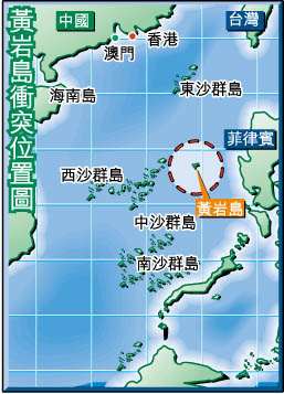
Title: Positions of Xisha (Paracels), Zhongsha(Macclesfield Bank), Dongsha (Pratas), Nansha (Spratlys) Islands and Huangyan Dao (Scarborough Shoal)
Author/Publisher
Date
Provider
Size: 19K
Description: Positions of South China Sea Islands: Spratly Islands,paracel islands,macclesfied bank,pratas island, scarborough shoal
preview:
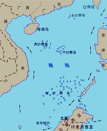
Title: Position of Four Sands in the South China Sea
Author/Publisher
Date
Provider
Size
Description
preview:
click on it to enlarge
Title: Map and Stamp of Spratly Islands and South China Sea Published by Taipei
Author/Publisher
Date
Provider
Size: 35K
Description: Stamps with Map of Spratly Islands and South China Sea Published by Taipei
preview:

click on it to enlarge
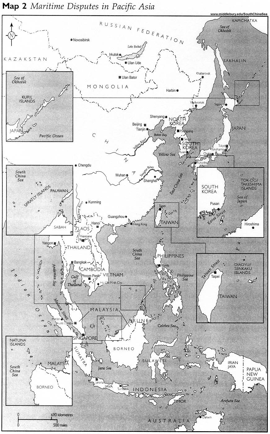
Title: Maritime Dispute in Asia Pacific
Author/Publisher
Date
Provider
Size
Description: Maritime Dispute in Asia Pacific: Spratly Islands, Kuril Islands, Diaoyu Dao etc.
preview:
click on it to enlarge
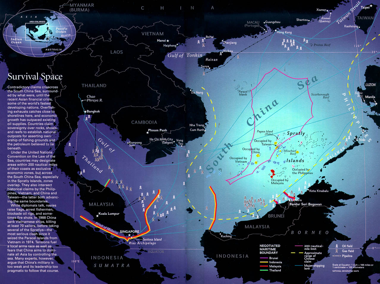
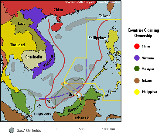
Title: Boundary Claims and Oil, Gas Fields in the South China Sea
Author/Publisher: National Geographic
Date: 1998
Provider
Size: 269K
Description: South China Sea Boundaries, Claims, Oil Gas Fields etc
preview:
click on it to enlarge
Title: Boundary Claims and Oil/Gas Fields on South China Sea
Author/Publisher
Date
Provider
Size: 50K
Description: Another map showing the boundary claims of Spratly Islands
preview:
click on it to enlarge
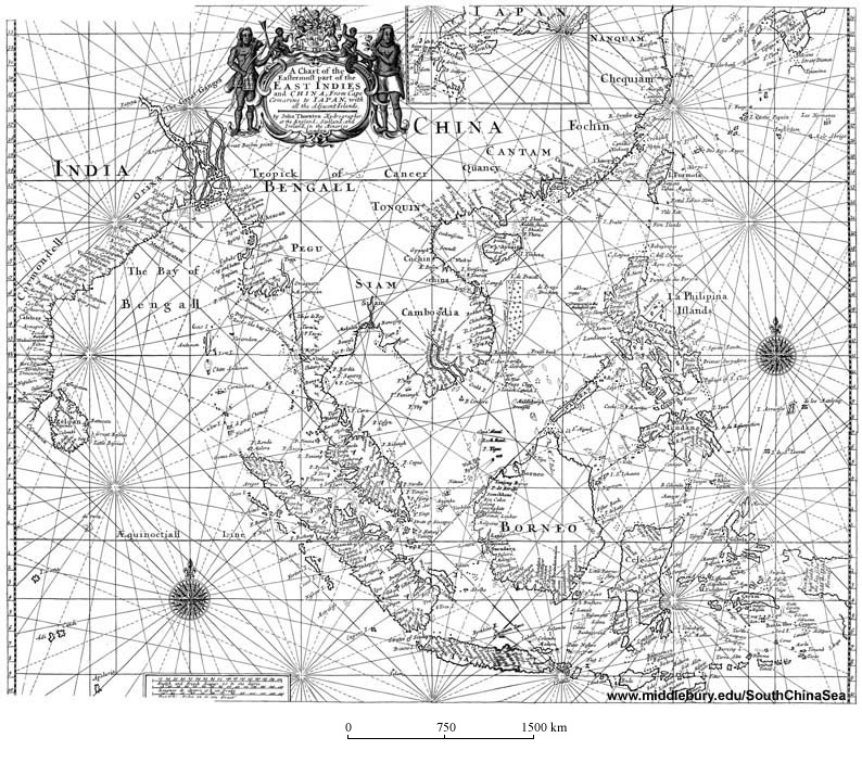
Title: Ancient Map Showing East Asia and China, South China Sea etc
Author/Publisher
Date
Provider
Size: Medium size map: 249K; Full Size map: 1.86MB
Description: Ancient Map Showing East Asia and China, South China Sea etc. The Long Bar Area east of today's Paracel Islands is named Pracell Islands in this Map. While today's Xisha (Paracel) Islands is named de. Pruys Drochten, showing the changing locations referred by the name Paracel (Pracel) in the history of Sea exploration
preview:
click on it to enlarge
Title: Boundary Claims in Spratly Islands in 1988
Author/Publisher
Date: 1988
Provider
Size: 223K
Description: Boundary Claims in Spratly Islands in 1988
preview:

click on it to enlarge
Title: Spratly Islands (Nansha Islands) Positions and Occupation Status
Author/Publisher
Date
Provider
Size
Description
preview: 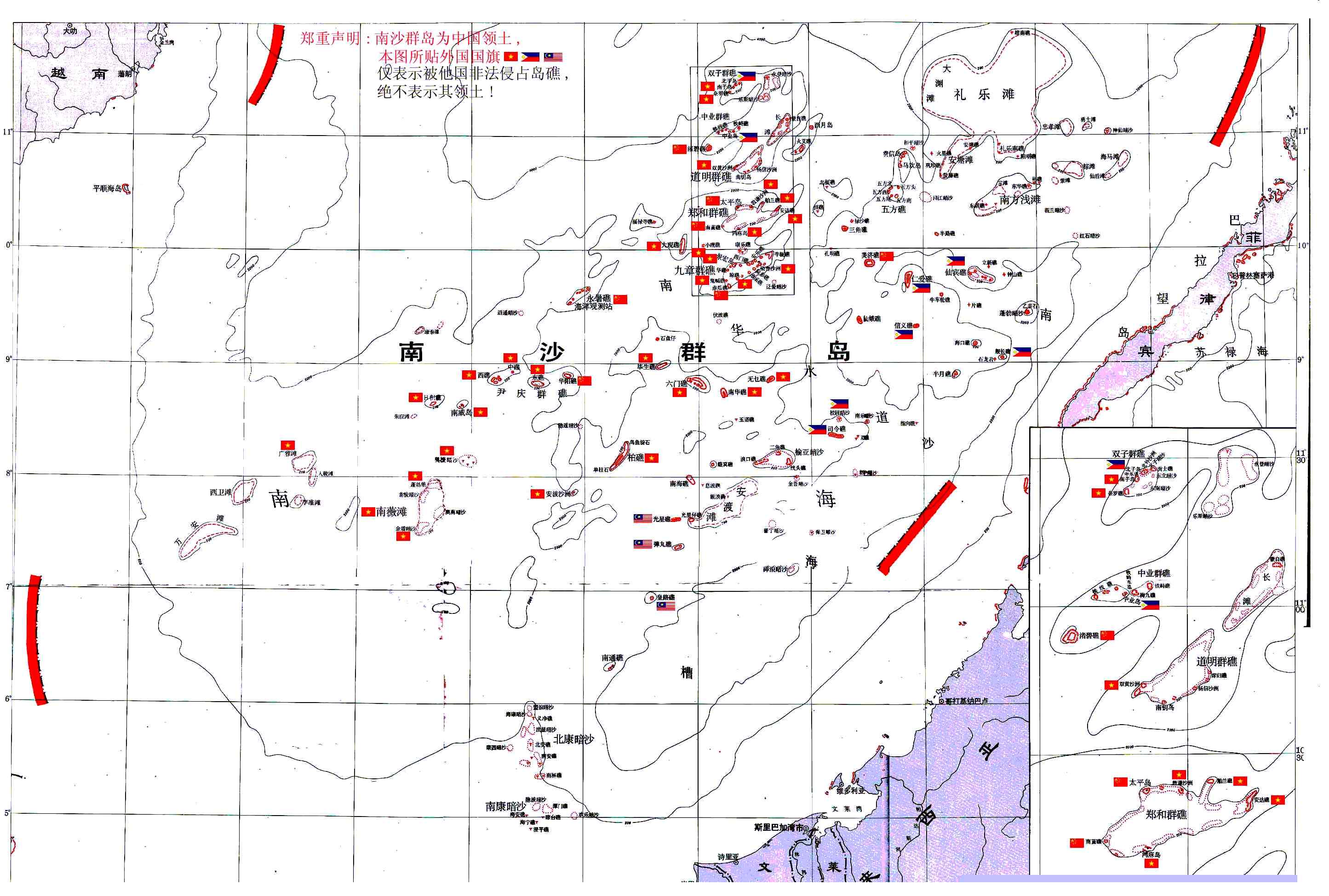
click on it to enlarge
Title: The Spratly Islands on British Admiralty Chart 2660B
Author/Publisher: British Admiralty
Date
Provider
Size: 168K
Description: The Spratly Islands on British Admiralty Chart 2660B
preview 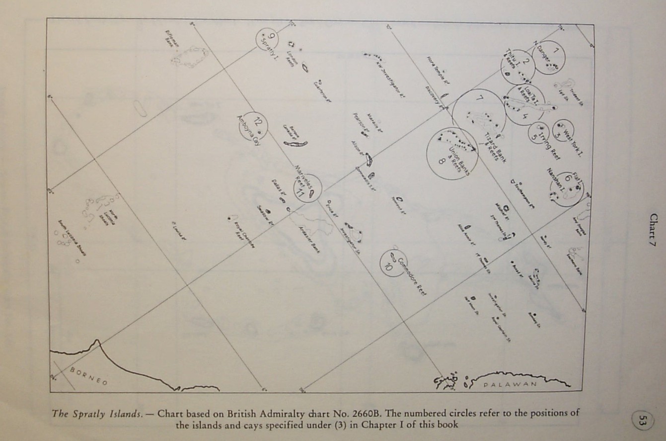 click on it to see big map