Title:
East Asia Terrain & Part of South China Sea
Author/Publisher
Date: 22 Nov 2004
Provider
Size: 260K
Description: East Asia Terrain & Part of South China Sea
Preview 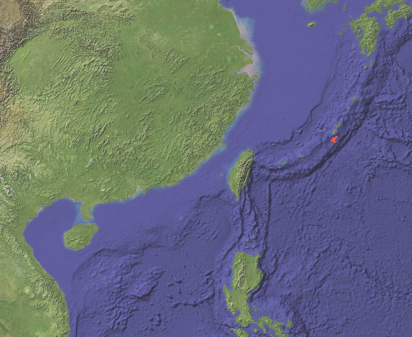 click to see big image
Title:
Southeast Asia Bathymetry & Terrain
Author/Publisher
Date: Nov 2004
Provider: http://www.es-geo.com/shadrelf.htm
Size: 103K
Description: Southeast Asia Bathymetry & Terrain, South China Sea
Preview 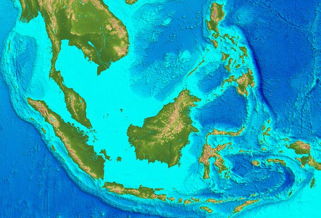 click to see big image
Title:
Occupation Status of Spratly Islands in year ??
Author/Publisher
Date
Provider
Size: 57K
Description: Occupation Status of Spratly Islands in year ??
Preview 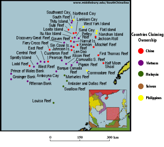 click to see big image
Title:
Spratly Islands Map 1994
Author/Publisher: Magellan Geographix
Date
Provider
Size: 86K
Description: Spratly Islands Map 1994
Preview 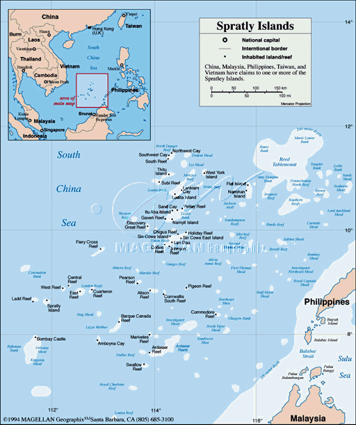 click to see big image
Title:
Spratly Islands Map 1997
Author/Publisher: Magellan Geographix
Date
Provider
Size: 45K
Description: Spratly Islands Map 1997
Preview  click to see big image
Title:
Spratly Islands Map 1997(?)
Author/Publisher
Date
Provider
Size: 28K
Description: Spratly Islands Map 1997(?)
Preview 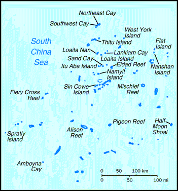 click to see big image
Title:
Spratly Islands Map year?
Author/Publisher
Date
Provider
Size: 12K
Description: Spratly Islands Map year? Occupation Status
Preview 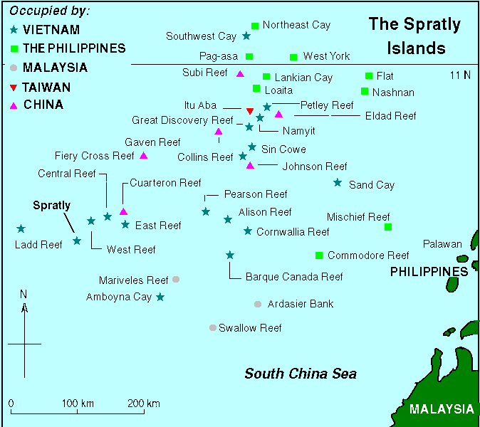 click to see big image
Title:
Position and Distance of Pratas Islands to Itu Aba Island
Author/Publisher
Date
Provider
Size: 20K
Description: Position and Distance of Pratas Islands to Itu Aba Island
Preview 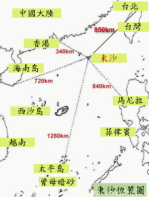 click to see big image
Title:
Map of South China Sea Islands in 1935
Author/Publisher: Chinese Government of 1935
Date: April 1935
Provider
Size: 943K
Description: Map published by Chinese government in 1935. This map was published after the Chinese and English Names for the South China Sea Islands were published in January 1935.
Preview 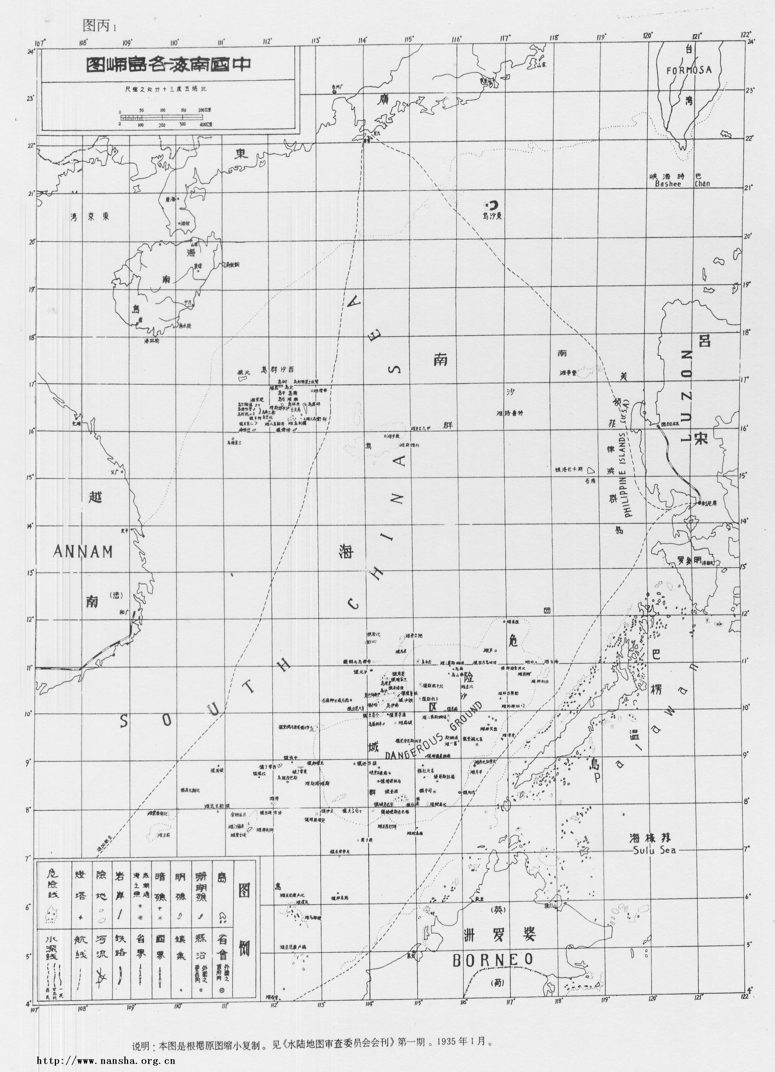 click
to see big image
click
to see big image
Title:
Map of South China Sea Islands in 1947, after recovery of Paracel and Spratly Islands from Japan
Author/Publisher: Ministry of Internal Affairs, China, 1947
Date: December 1, 1947
Provider
Size: 929K
Description: This map was published by the Ministry of Internal Affairs, Republic of China in 1947, after the recovery of the South China Sea Islands including Paracels and Spratlys from Japanese in 1946. In the same year a revised name list of the South China Sea Islands were published by Ministry of Internal Affairs in 1947.
Preview 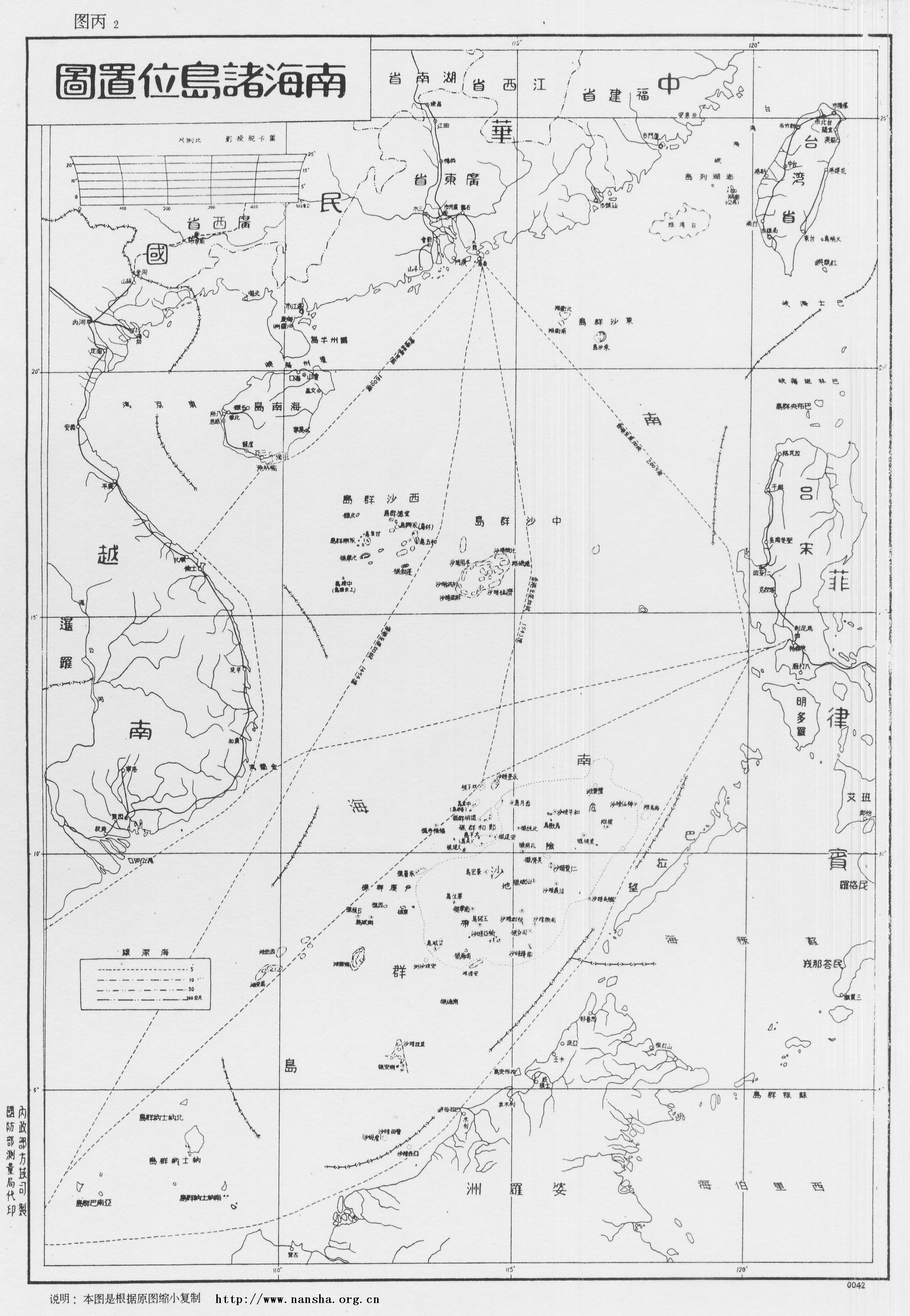 click to see big image